Design Automation Lab
A research lab developing methods and tools for supporting design decision making.
Irradiance Mapping
- Title: Irradiance Mapping for Large-Scale City Models: The Singapore Solar PV Roadmap
- Project Period: Jun 2019 to Jun 2020
- Funding Source: NUS SERIS
- Principal Investigator: Patrick Janssen (PI)
- Budget: SGD $10,520
Research Overview
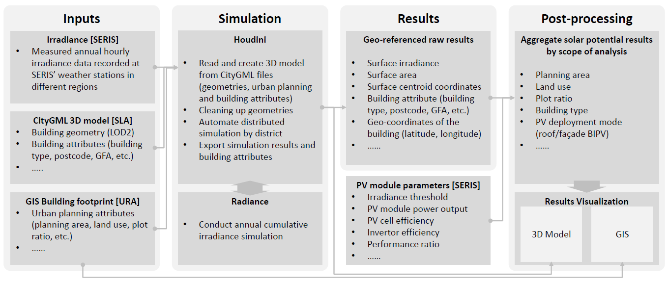
To plan future energy transitions, city planners need to be able to assess the maximum potential contribution of PV systems on building roofs and facades in terms of electricity generation. One key component of such an assessment is the ability to perform a detailed city-wide simulation of solar irradiance incident on building roofs and facades throughout the year. This is referred to as ‘irradiance mapping’.
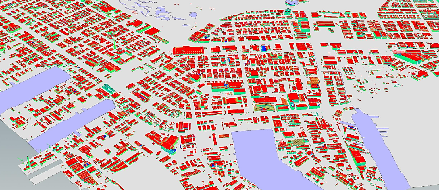
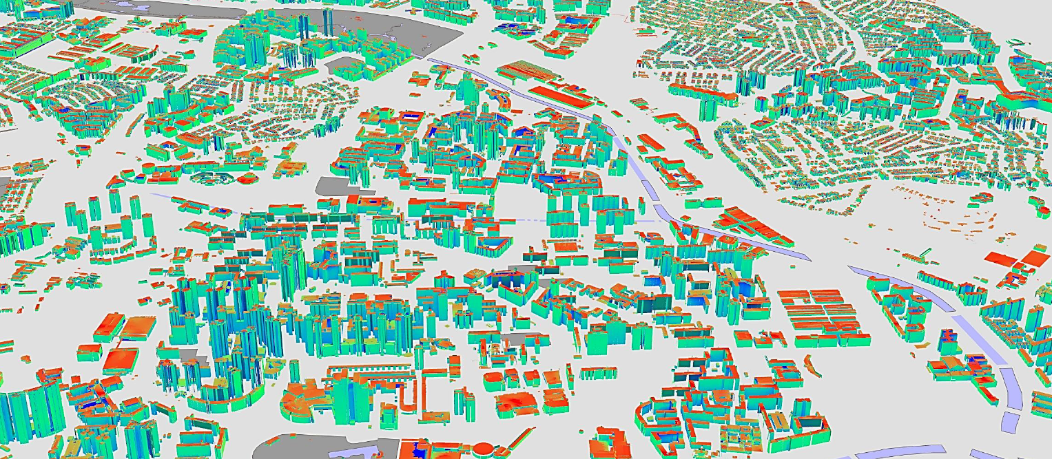
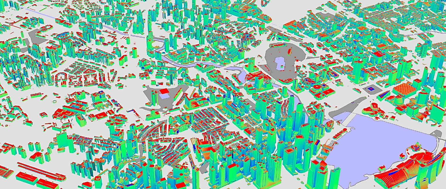
This research developed a scalable parallelised irradiance mapping workflow for the Singapore 3D city model in CityGML format. The Singapore CityGML data set consisted of 158,000 files organized into a hierarchical folder structure. The model was created based on a set of Light Detection and Ranging (LiDAR) scans. Two LOD models were given: LOD1 and LOD2. For the irradiance mapping, the LOD2 model was used.
The proposed workflow uses three main tools: Radiance, Houdini, and Tableau. Radiance is a suite of validated programs widely used for various types of lighting simulation, including irradiance simulation. Houdini is a 3D procedural modelling application, primarily focused on the digital effects industry. Tableau is a web-application that supports advanced data analysis and visualization.
In the proposed workflow:
-
The Radiance suite of programs are used to perform the irradiance calculations.
-
Houdini is used to automate the process of manipulating the city model and executing Radiance, using advanced procedural modelling and parallel processing techniques.
-
Tableau is used to post-process the output data generated by the simulations and to create a series of user-friendly data visualisations.
The proposed workflow was used to perform teh following tasks:
-
Obtain annual cumulative irradiance for rooftop and façade surfaces through simulation for the total building stocks of Singapore for island-wide irradiance mapping.
-
Produce geo-referenced results to support solar potential assessment by planning areas, land use, building type, PV deployment mode, etc.
-
Facilitate visualization of the aggregated results on 3D modelling platforms.